Zheng He
Ports, monsoons and Ming maritime missions
Journeys and exchange
On this page
Life overview
Zheng He led Ming maritime missions linking Chinese departure ports with Southeast Asia and the Indian Ocean. Five stages follow his origins and selected port connections. Fleet visits, mission-wide date ranges and his individual movements are distinguished; the connecting lines are not reconstructed sailing tracks.
Places and turning points
Dashed lines show the order of selected places, not an exact travel route.
1371 (conventional year)
Origins in Kunyang
Kunyang, present-day Jinning, Yunnan City-level representative point
Zheng He came from Kunyang in Yunnan, within present-day Jinning. Born with the surname Ma, he later entered service in the Ming imperial household and became known as Zheng He. This opening point locates his background; it does not imply that an overland journey from Yunnan to the maritime ports followed the map’s straight line.
City-level reference; the marker does not identify a particular room or building.
Representative coordinates · 24.669°, 102.594°
1405–1407: first voyage
The first mission sets out
Taicang and Liujiagang City-level representative point
Zheng He and Wang Jinghong led the first Ming mission from the lower Yangtze port network toward Southeast Asia and the Indian Ocean. Liujiagang in Taicang was a departure and assembly point, followed by preparations in Fujian. A fleet’s departure from one port and its final sailing into open ocean need not share one date.
City-level reference; the marker does not identify a particular room or building.
Representative coordinates · 31.459°, 121.13°
1409–1411: third voyage
A staging base at Malacca
Malacca, present-day Melaka City-level representative point
During the third voyage, the fleet used Malacca as a provisioning, storage and assembly base. Its location near the strait helped connect voyages between the South China Sea and the Indian Ocean. The date range belongs to the expedition; it does not mean Zheng remained continuously in the city for two years.
City-level reference; the marker does not identify a particular room or building.
Representative coordinates · 2.1896°, 102.2501°
1413–1415: fourth voyage
Reaching the Hormuz trading region
Hormuz, Persian Gulf entrance Representative area
The fourth voyage extended the fleet’s recorded activity to Hormuz, a trading centre at the entrance to the Persian Gulf. Exchanges of gifts and diplomatic credentials linked the mission to existing regional commerce. The marker represents the historical port region, not an exact anchorage or a claim that every vessel followed the same course.
Regional marker for historical Hormuz; an individual anchorage and exact arrival date are not established.
Representative coordinates · 27.06°, 56.46°
1431
An inscription before the last mission
Changle, Fujian City-level representative point
Before the seventh mission, Zheng He and fellow commanders waited for favourable winds at Changle and commissioned the Tianfei inscription. Its retrospective account documents earlier voyages and local preparations. As a contemporary statement by the mission’s leaders, it is valuable evidence while also expressing their own religious and political framing.
City-level reference; the marker does not identify a particular room or building.
Representative coordinates · 25.963°, 119.523°
Legacy and context
The voyages combined diplomacy, exchange and demonstrations of Ming state power. Surviving inscriptions and voyage accounts provide valuable evidence but leave gaps. The conventional endpoint around 1433 is approximate; a different death date of 1435 also appears in scholarship.
Bibliography
- 中国科学院地理科学与资源研究所:航海家——郑和 (Chinese source)
- 郑和研究会:郑和船队七次下西洋(上海中国航海博物馆提供) (Chinese source)
- 华东师范大学学报:郑和下西洋与明朝的“麒麟外交” (Chinese source)
- 福州市人民政府:闽江潮头说郑和 (Chinese source)
- 故宫博物院:林梅村《郑和海外遗迹调查》 (Chinese source)
References support specific dates and context. Bibliographies are displayed as text.
Image and source
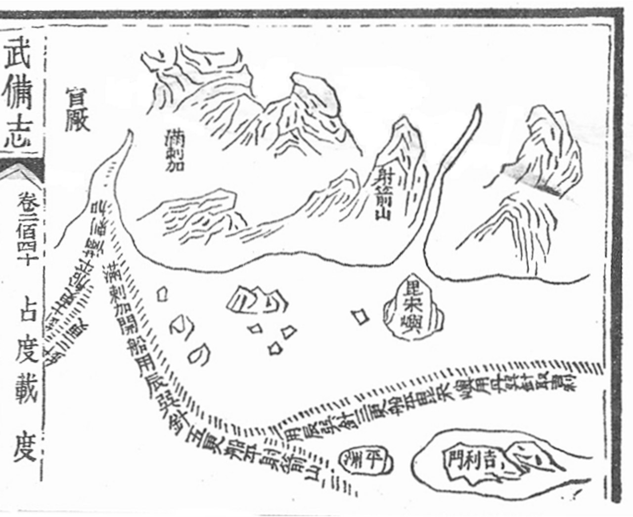
Mao Kun map of Melaka
A seventeenth-century woodblock map from the Wubei Zhi tradition, based on information from Zheng He’s voyages. It is a later published navigational record, not a map sheet dated 1405.
- Creator
- Mao Yuanyi, and unknown cartographer
- Collection / image provider
- National Library Board, Singapore · Wikimedia Commons
- Source and reuse
- Source record · Public domain
The source identifies this image as public domain. Consult its item-specific rights record and terms below; CivAtlas does not claim new copyright or grant additional rights in this image.
Public domain, as identified in the source record. Source credit: Mao Yuanyi, and unknown cartographer. Reuse terms: Public domain.