Yi Sun-sin
Naval command, coastal geography and a wartime diary.
Public life
On this page
Life overview
Yi Sun-sin was a naval commander of Joseon during Japan’s invasions of 1592–1598. These stages connect his capital origins, the Yeosu command and three battle regions. The map shows selected places in his life, not reconstructed fleet movements or modern national borders in the sixteenth century.
Places and turning points
Dashed lines show the order of selected places, not an exact travel route.
1545
Born in the capital
Hanseong, now Seoul City-level representative point
Yi Sun-sin was born in Geoncheon-dong in Joseon’s capital, Hanseong. The city is now Seoul; the pin does not identify a surviving birthplace building. His later naval career unfolded far to the south, so this first stage establishes his origins before the coastal commands and battle regions that follow.
City-level representative point; it does not locate a particular room, institution or travel route.
Representative coordinates · 37.5665°, 126.978°
1592, seventh lunar month, day 8
A combined fleet at Hansan
Waters near Hansan Island Representative area
During Japan’s invasion, Yi and other Joseon commanders fought a Japanese fleet near Hansan Island. They drew opponents out from narrower waters and deployed a spreading formation in the wider sea. The victory belongs to a combined naval operation, not a lone individual; the pin marks a battle region rather than a precisely reconstructed manoeuvre.
Representative point for the historical battle waters, not an exact ship position, casualty site or reconstructed sailing track.
Representative coordinates · 34.77°, 128.47°
1597, ninth lunar month, day 16
Rebuilding command at Myeongnyang
Myeongnyang Strait, near Jindo Representative area
After dismissal and a later return to naval command, Yi led a reduced force at Myeongnyang, the narrow strait between Jindo and Haenam. The fleet resisted a larger Japanese force, preserving a basis for further naval operations. This location highlights the strait’s geography; it does not trace every ship’s movement or claim an exact casualty count.
Representative point for the historical battle waters, not an exact ship position, casualty site or reconstructed sailing track.
Representative coordinates · 34.572°, 126.309°
1598, eleventh lunar month, day 19
The final battle at Noryang
Noryang Strait Representative area
Yi’s Joseon fleet and Ming forces under Chen Lin fought Japanese ships near Noryang as the war was ending. Yi was killed during the battle. His diary had recorded the preceding years’ combat, weather and daily hardships; later accounts preserve additional memories. The regional point does not identify the vessel or exact place of his death.
Representative point for the historical battle waters, not an exact ship position, casualty site or reconstructed sailing track.
Representative coordinates · 34.938°, 127.87°
Legacy and context
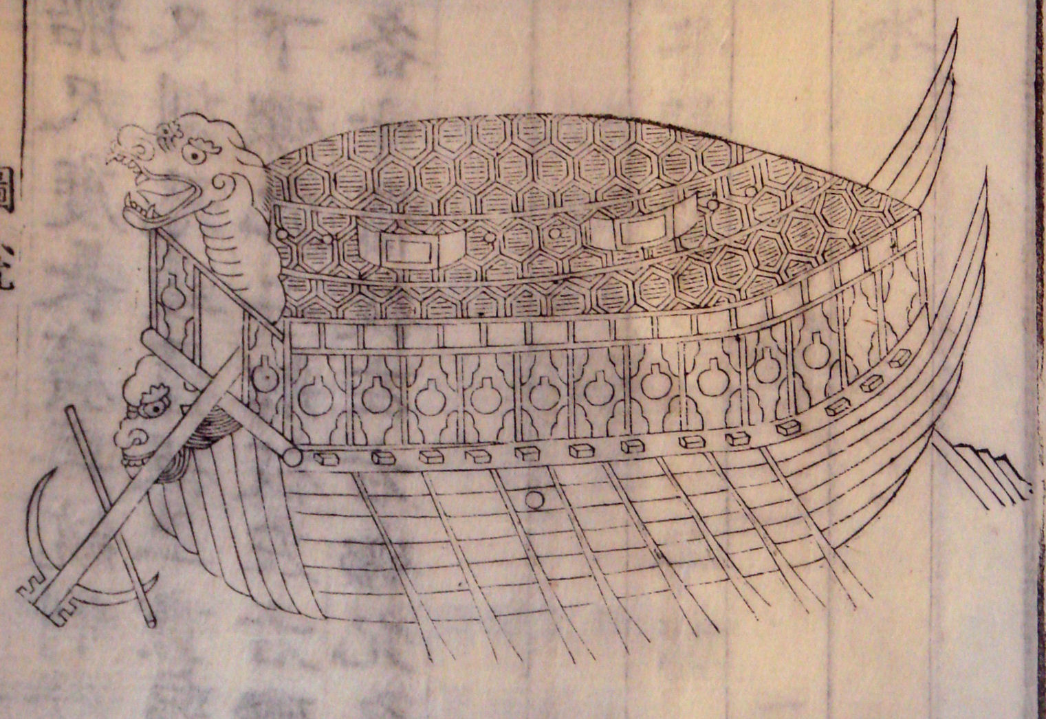
His campaigns depended on crews, ships, preparation and other commanders, including Ming allies in the final battle. His surviving diary records war alongside weather, loss and everyday concerns. Later turtle-ship illustrations are useful historical objects, but cannot simply be treated as exact pictures of his own vessels.
Bibliography
- Sejong Center: The Story of Admiral Yi Sunshin
- National Institute of Korean History: Yi Sun-sin
- Seoul Metropolitan Government: Monument to Twelve Victories
- UNESCO: Nanjung Ilgi—War Diary of Admiral Yi Sun-sin
References support specific dates and context. Bibliographies are displayed as text.
Image and source
Turtle-ship woodcut of 1795, photographed in 2007
PHGCOM’s 2007 photograph of a turtle-ship woodcut dated 1795, taken at the British Museum. Made nearly two centuries after Yi’s death and based on a late-eighteenth-century model, the depiction is not an exact record of a vessel he commanded. Original image unchanged; CC BY-SA 3.0.
- Creator
- Unidentified woodblock artist; photograph by PHGCOM
- Collection / image provider
- British Museum (photograph location reported by the photographer) · Wikimedia Commons
- Source and reuse
- Source record · Creative Commons Attribution-ShareAlike 3.0 Unported
Reuse is governed by the original license linked below, including required credits, license links and notices of changes. Follow ShareAlike terms where the license requires them. CivAtlas does not grant additional rights in third-party images. For other uses, consult the rights contact identified by the original source.
Source credit: Unidentified woodblock artist; photograph by PHGCOM. Reuse terms: Creative Commons Attribution-ShareAlike 3.0 Unported. PHGCOM, TurtleShip1795.jpg, Wikimedia Commons, CC BY-SA 3.0 (https://creativecommons.org/licenses/by-sa/3.0/). Original JPEG, unchanged.