Ashoka
Conquest, royal edicts and the language of dhamma
Public life
On this page
Life overview
Ashoka ruled the Mauryan Empire in the third century BCE. Inscriptions provide unusually direct evidence for his policies, while later Buddhist traditions preserve narratives that require separate evaluation.
Places and turning points
Dashed lines show the order of selected places, not an exact travel route.
c. 268 BCE
Inheriting the Mauryan state
Pataliputra / present-day Patna City-level representative point
Ashoka inherited an extensive state centred on the Gangetic plain. Pataliputra was a royal capital, connected to provincial officials, taxation and military resources. His accession is conventionally placed around 268 BCE, although chronologies differ. The city marker supplies a political centre, not a verified coronation hall or a reconstructed early itinerary.
City-level marker; no individual building is asserted.
Representative coordinates · 25.61°, 85.14°
c. 261 BCE
Conquest and the cost of war
Kalinga / present-day Odisha Representative area
Ashoka’s conquest of Kalinga brought death, deportation and suffering, described in his own later edict. The account presents remorse and a preference for moral conquest, but remains a royal statement. Kalinga is shown as a region; the marker does not establish the exact battlefield or independently verify the inscription’s casualty figures.
Regional reference point, not a verified camp or exact route.
Representative coordinates · 20.194°, 85.839°
c. 257–250 BCE · broad phase
Royal orders in stone
Girnar / Junagadh region Representative area
The rock edicts preserved at Girnar explain duties toward parents, religious communities, people and animals, and the work of officials. They reveal communication across a multilingual empire. This marker identifies evidence of royal administration rather than a proven personal visit, and the date represents a broad inscriptional phase rather than one documented day.
Regional reference point, not a verified camp or exact route.
Representative coordinates · 21.522°, 70.469°
c. 249 BCE · conventional conversion
A pilgrimage recorded by a pillar
Lumbini City-level representative point
The Lumbini pillar records Ashoka’s visit to a place identified with the Buddha’s birth. It links royal presence, pilgrimage and privileges granted to the settlement. The familiar BCE date is a conversion from regnal chronology. Later buildings around the site should not be mistaken for structures standing at the time of his visit.
City-level marker; no individual building is asserted.
Representative coordinates · 27.47°, 83.276°
c. 232 BCE · conventional endpoint
A royal programme beyond one lifetime
Pataliputra / present-day Patna City-level representative point
Ashoka’s reign is conventionally taken to end around 232 BCE. His inscriptions remained after the political unity of the Mauryan state eventually broke down. This return to the capital is a frame for the reign’s conclusion, not a claimed deathbed location; later Buddhist accounts and surviving decrees preserve different kinds of evidence.
Capital used for the reign’s conclusion; exact deathplace is not established here.
Representative coordinates · 25.61°, 85.14°
Legacy and context
His inscriptions connect authority with moral conduct and welfare, alongside the continued power of an empire. Their survival does not prove that every royal aspiration was implemented uniformly.
Bibliography
- OpenStax, Rice University: The Mauryan Empire
- National Museum, New Delhi: Rock edicts
- UNESCO: Lumbini
- S. Dhammika: The Edicts of King Ashoka — Colorado State University archive
References support specific dates and context. Bibliographies are displayed as text.
Image and source
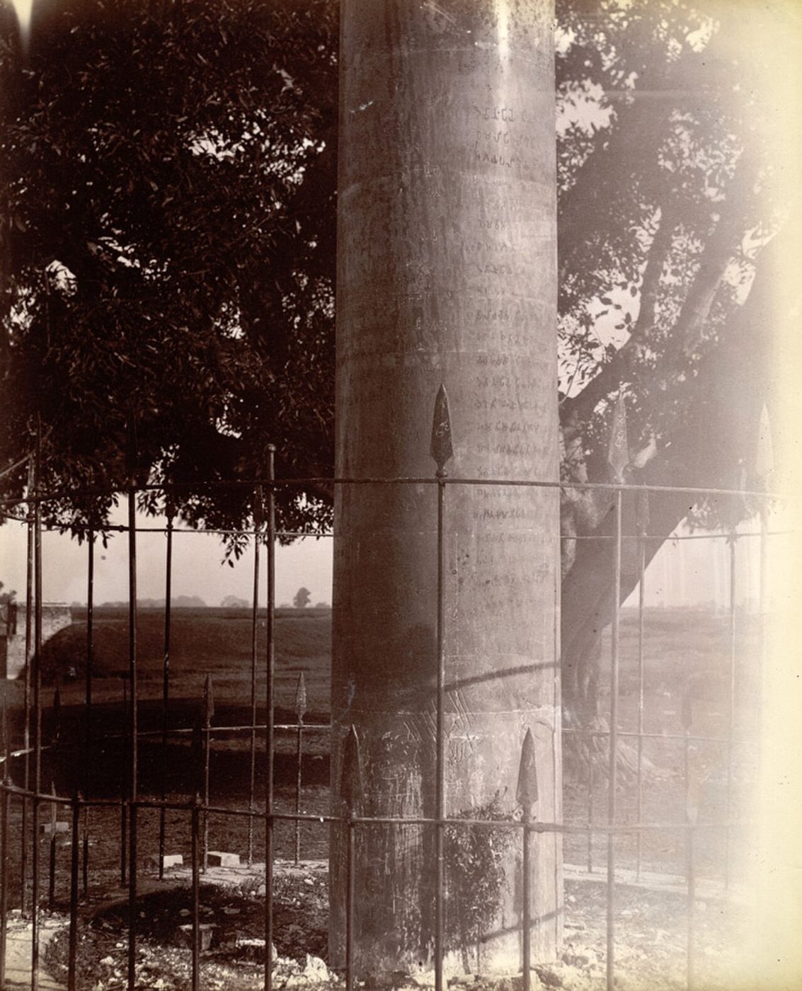
Ashokan pillar at Lauriya Nandangarh in 1865
Benjamin Simpson’s 1865 photograph of the Ashokan pillar at Lauriya Nandangarh. It records the surviving Mauryan monument in the nineteenth century, not Ashoka’s reign itself.
- Creator
- Sir Benjamin Simpson
- Collection / image provider
- Department of Tourism, Government of Bihar · Wikimedia Commons (British Library digitization)
- Source and reuse
- Source record · Public domain
The source identifies this image as public domain. Consult its item-specific rights record and terms below; CivAtlas does not claim new copyright or grant additional rights in this image.
Public domain, as identified in the source record. Source credit: Sir Benjamin Simpson. Reuse terms: Public domain.